
Home Logiroad Center Road Tracksides
Get a complete inventory of your tracksides on the Logiroad Center platform to optimise your maintenance work.
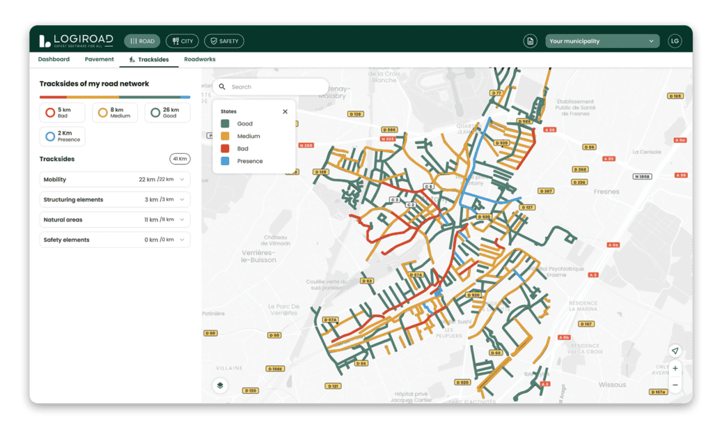
When we diagnose your pavement for you using video footage, we can feed your various types of tracksides into the Logiroad Center platform.
This gives you a map view of the location, type, coating and condition of these tracksides, projected laterally. You can quickly identify the length of necessary improvements and maintenance work (cutting, ditch clearing, etc.), while also integrating them with your roadworks.
They fall into four main categories:
• Mobility (cycle paths, bus lanes, pedestrian walkways)
• Structural elements (sidewalks, curbs, gutters)
• Natural areas (shoulders, ditches, hedges, embankments)
• Safety elements (guardrails)
Your tracksides are graded in 3 levels: good, medium, bad and also «presence» for natural aeras.
When we diagnose your pavement for you using video footage, we can feed your various types of tracksides into the Logiroad Center platform.
This gives you a map view of the location, type, coating and condition of these tracksides, projected laterally. You can quickly identify the length of necessary improvements and maintenance work (cutting, ditch clearing, etc.), while also integrating them with your roadworks.
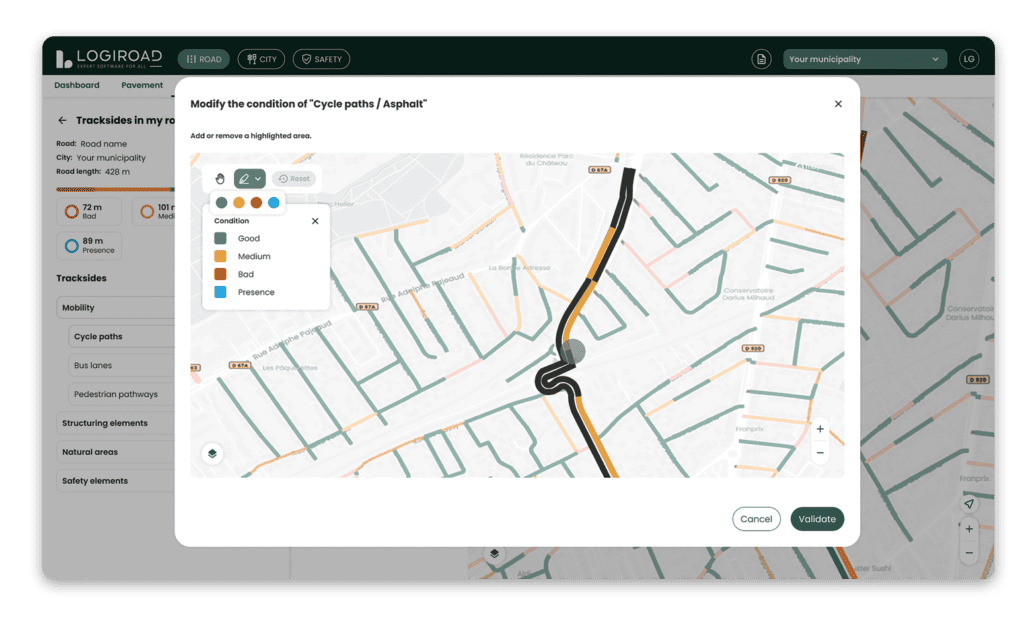
Modify the condition of your stracksides yourself. Remove or add an additional section according to its coating and in a lateralized manner, to the nearest meter.